


Project Updates
Dynamic Lands Lab
Software for spatiotemporal land analysis
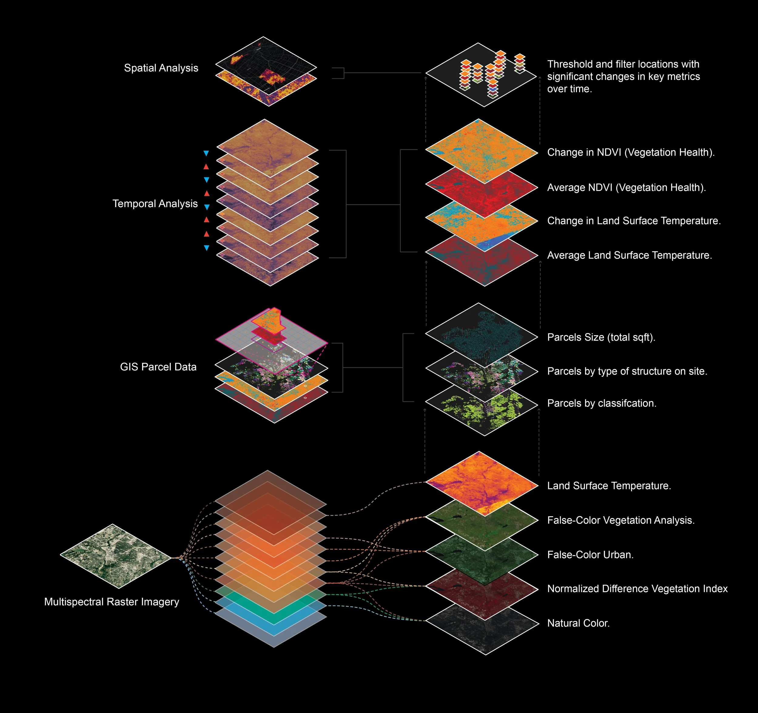
Dynamic Lands Lab integrates multispectral satellite imagery, LiDAR, aerial imagery and GIS data to reveal environmental, contextual and temporal dynamics to inform site selection and early-stage design decisions.
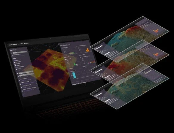
Data delivery with interactive analysis tools
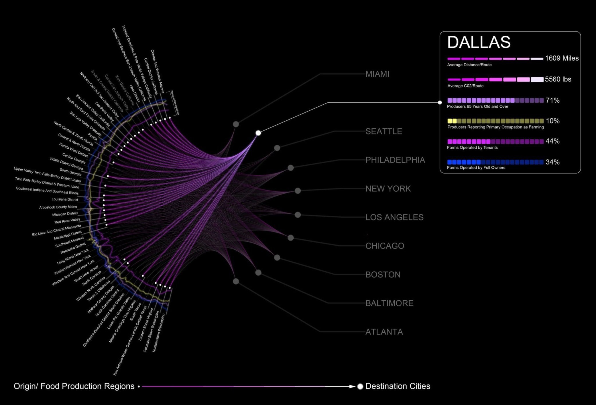
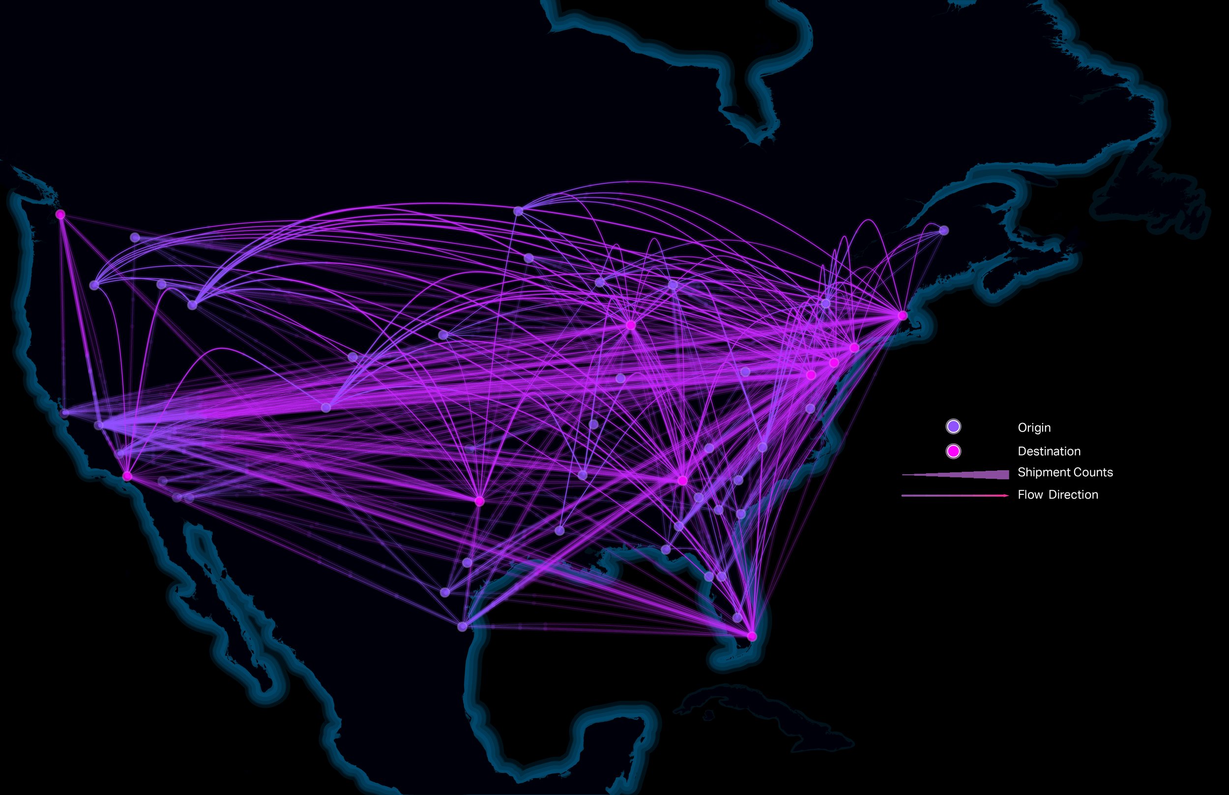
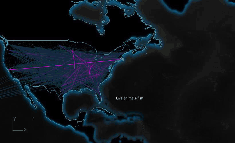
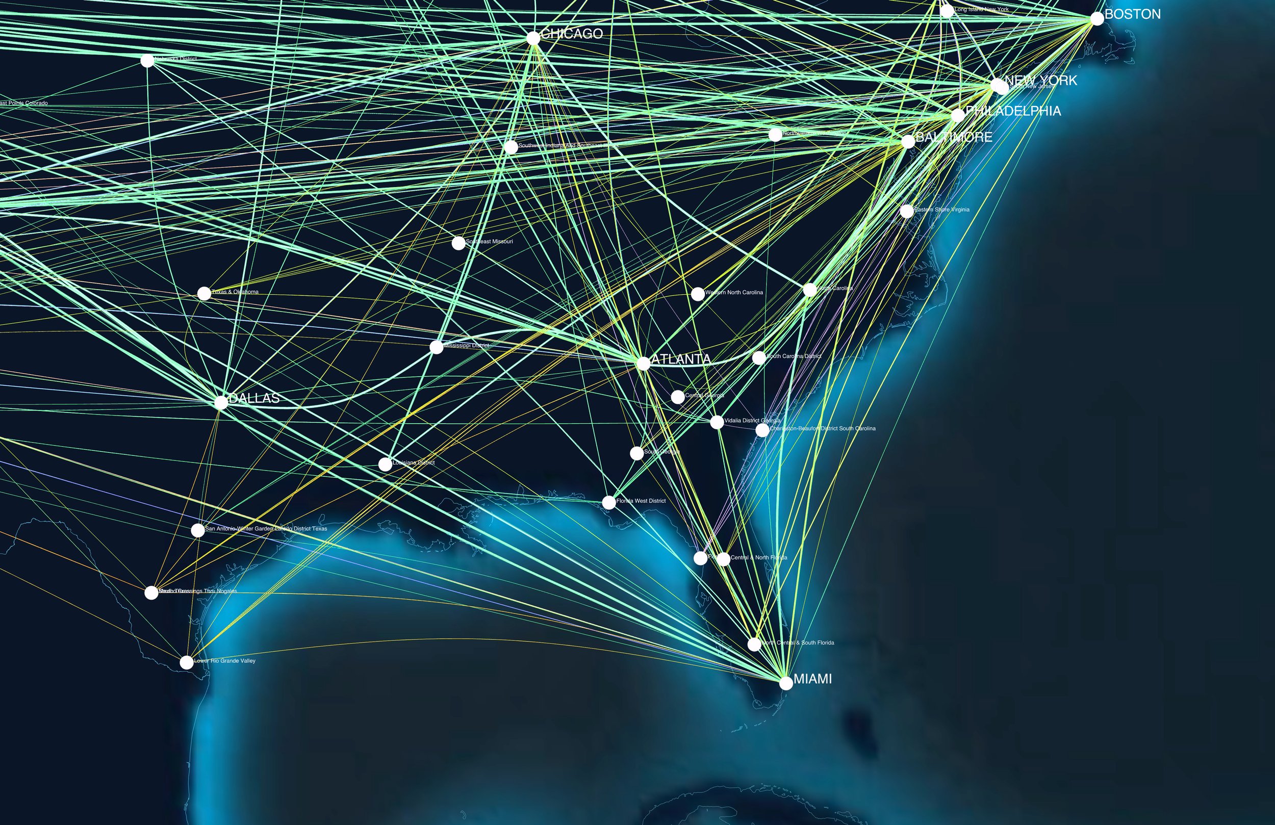
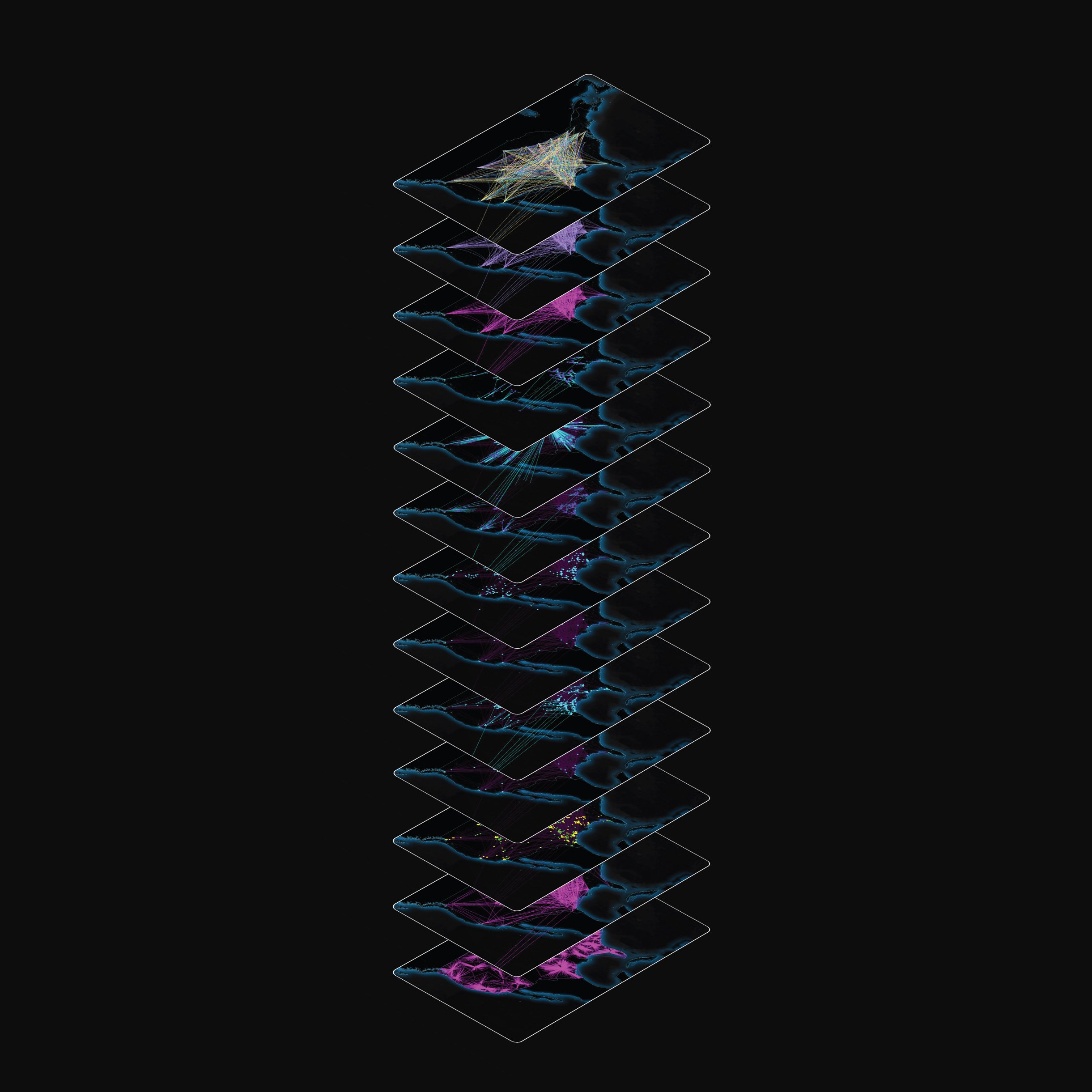
Dynamic Lands Lab delivers preprocessed geospatial intelligence that helps users understand land dynamics with clarity. From monitoring vegetation health and surface temperatures to assessing proximity to critical built environment features, our multispectral and spatial analyses provide timely insights that support better decision-making. Whether you’re evaluating agricultural suitability, studying site conditions, or exploring socioeconomic context, Dynamic Lands Lab makes advanced spatial analysis accessible through intuitive web tools, 3D-design integrations, and on-site drone imagery.
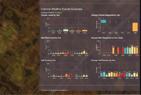
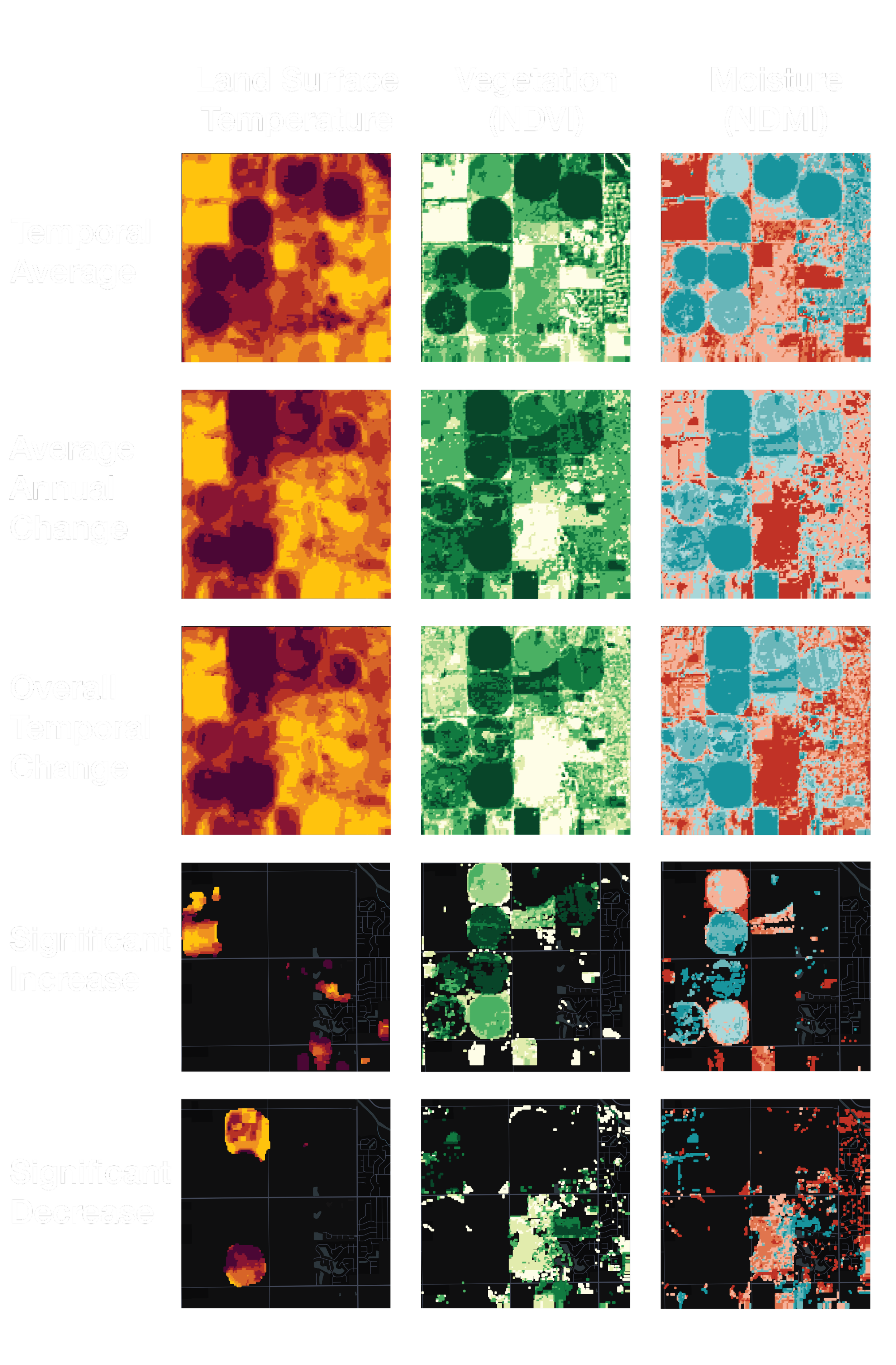
Identify spatiotemporal patterns with multispectral analysis
Spatiotemporal analysis of surface temperature, NDVI, and NDMI reveals how land conditions evolve over time, highlighting the impacts of management practices, climate pressures, and environmental change. By measuring long-term trends, annual shifts, and areas of significant increase or decline, you can pinpoint where vegetation is stressed, soil moisture is changing, or heat is intensifying insights that support smarter decisions for improving crop performance, reducing heat impacts, and guiding more effective land stewardship.
Learn more about the project here
Recent Blog Updates