Most geospatial data exists in fragmented formats (GeoTIFFs, shapefiles, and other domain-specific structures) requiring specialized tools to access and interpret. While existing platforms support data aggregation and visualization, they often lack tools for analyzing how site conditions evolve over time.
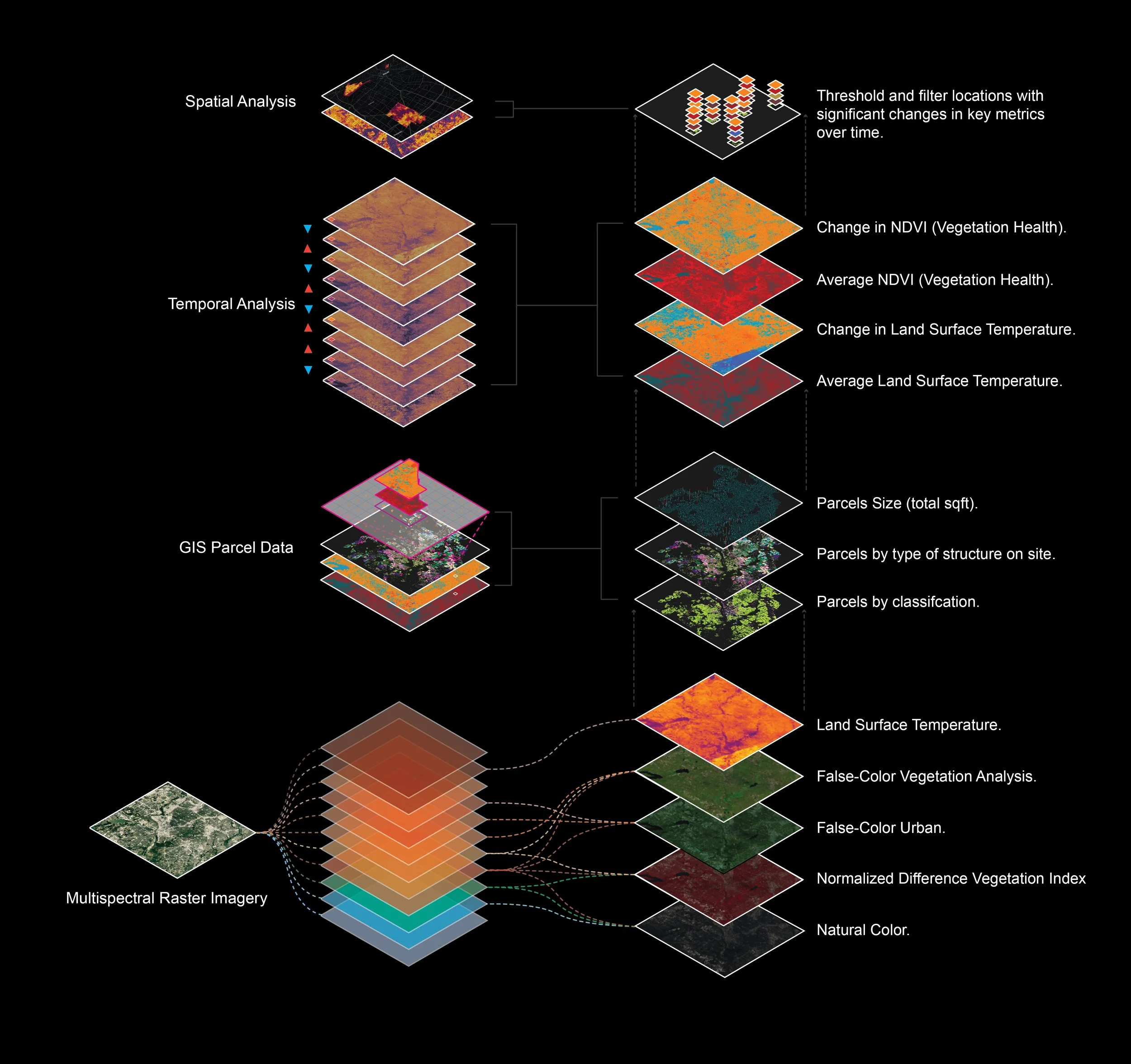
Dynamic Lands Lab is an independently developed system focused on spatiotemporal analysis, transforming heterogeneous geospatial data into structured datasets that capture patterns of change across terrain, vegetation, and environmental conditions. The goal is not just to describe what a site is, but how it changes.
The project grew out of prior work with Landsat data in urban heat island research and subsequent exploration across planning and land-use contexts, where a consistent gap became clear: limited infrastructure for integrating and analyzing spatial data as a unified, time-aware system. DLL addresses this by standardizing inputs, deriving composite metrics, and producing analysis-ready outputs.
Development & Iteration Loop
Market Signals / Use Cases
Geospatial community engagement
Real-World workflows
Identified gaps in tooling
Feature Design
Targeted pipeline development
Data processing and analytics layers
UI / visualization features
Development & Sharing
Ease of access
Minimized overhead
Web interfaces
Feedback & Validation
Reified analytics for non-technical stakeholders
Usability insights
Performance observations
Refinement & Iteration
Pipeline optimization
UI/UX refinement
Feature expansion
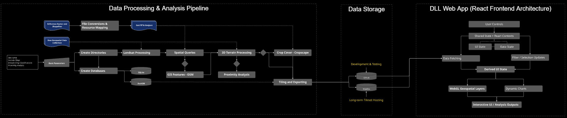
System Architecture & Data Flow
End-to-end architecture of the Dynamic Lands Lab, from data ingestion and processing to visualization and application layers.